
The voice of the Earth Observation
Industry
Barents bloom, Sentinel-2A - processed by ESA, CC BY-SA 3.0 IGO

Discover the largest European
Earth Observation Network
Lake Balkhash, Kazakhastan, Sentinel 2 - processed by ESA, CC BY-SA 3.0 IGO

EARSC promotes the understanding
of our Planet for societal benefits
Brussels, Spot 5 Sqtellite - Airbus Defence and Space
EARSC 4 Pillars

Representing the Members
The core pillar of our activities is to support and promote our members. We achieve this goal mainly through projects which we undertake (see projects). Members’ views are gathered through a series of ad-hoc working groups dedicated to important topics. We inform our members through a monthly report and a dedicated portal about important news and information, as announced bid opportunities – and dedicated e-mails for key items.
Read More
Market development & Internationalization
EARSC is engaged in a wide range of activities to develop new markets and business opportunities for our members. Our strategy is to engage users, identify needs and stimulate demand for European EO services both in Europe and abroad with complementary commercial and geographical approaches.
Read More
Promoting the industry
EARSC employs a range of sophisticated digital tools to promote the European EO sector. EARSC has three main digital tools which cover creating a shared vocabulary (EARSC TAXONOMY) , providing a common space to find EO companies, and a common space to discover ‘online’ EO services.
Read More
Showing the value of Earth Observation
The Earth observation sector delivers a wide range of social and environmental and economic benefits to citizens of Europe and the world. To properly and consistently value these impacts, EARSC leads the Sentinel Benefits Study (SeBS) project in which we measure the total societal impact of products and services coming from Sentinel satellite data.
Read MoreEARSC NEWS

ProseccEO Picture Competition 2021!
Because a picture is worth a thousand words, we are very happy to organize a picture competition to celebrate the end of the year! Please upload below the picture that best describes 2021 for you! Be creative and have fun! The deadline to submit your picture is the 13th December at 20:00 CET. The best picture will be chosen

Job Offer for ALPHA Consult: EO junior/ senior consultant (expertise in Sentinel 5 preferred)
ALPHA Consult has spun off from a leading strategy consultancy to specialize further on management consulting services in aerospace applications (chiefly GNSS, EO and UAVs) and related industries (e.g., LBS, Aviation, Rail, Road, Maritime, High precision, Agriculture, High tech, Telecommunications) in Europe and Africa. ALPHA Consult performs market analyses and forecasts, competitive environment assessments, business

EOcafe: Copernicus Commercial Data and New Space
“Copernicus Commercial Data and New Space”Thursday 4th November 2021 16h00-17h00 CEST The Copernicus programme provides access on a full, free and open basis to its Sentinel data. The thematic information products from its six Copernicus services are also made available on a full, free and open basis. This topical information is produced using Sentinel data
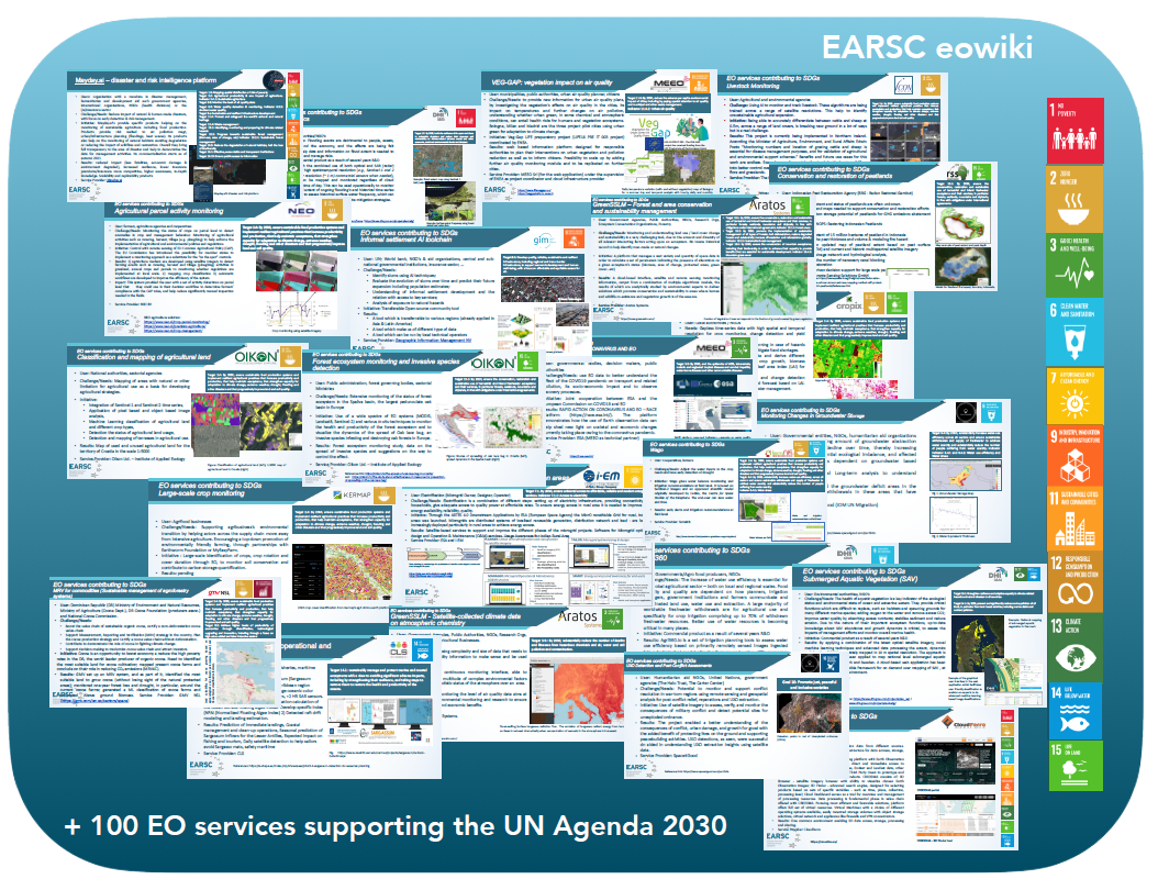
EO Services Industry Supporting the UN Agenda 2030
EO services industry supporting the UN Agenda 2030 The Sustainable Development Goals (SDGs) were adopted by the United Nations, with the aim of monitoring progress, informing policies and ensuring accountability. Earth Observation can support several targets and indicators in the UN SDG framework by providing accurate and reliable data on the state of natural resources,
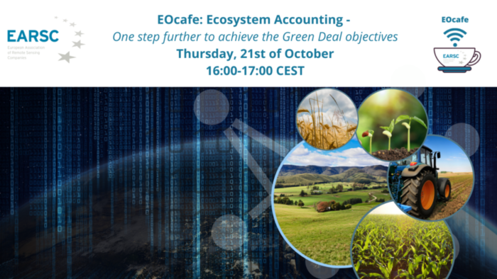
EOcafe: Ecosystem Accounting, one step further to achieve the Green Deal objectives
Ecosystem Accounting, one step further to achieve the Green Deal objectives Thursday 21 October 2021, 16h00-17h00 CEST The System of Environmental Economic Accounting (SEEA) is the accepted international standard for environmental-economic accounting, providing a framework for statistics on the environment and its relationship with the economy. It brings together economic and environmental information in an
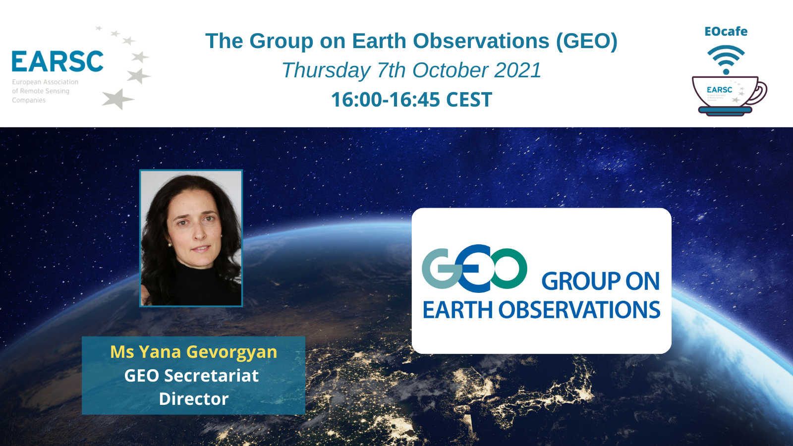
EOcafe: The Group on Earth Observations (GEO)
The Group on Earth Observations (GEO) Thursday 7th October 2021, 16:00-16:45 CEST The Group on Earth Observations (GEO) is a partnership of governments and organizations envisioning a future whereby decisions for human-kind will be informed by timely, reliable, openly shared science-based environmental information underpinned by systematic Earth observations. GEO gathers together over 113 countries and
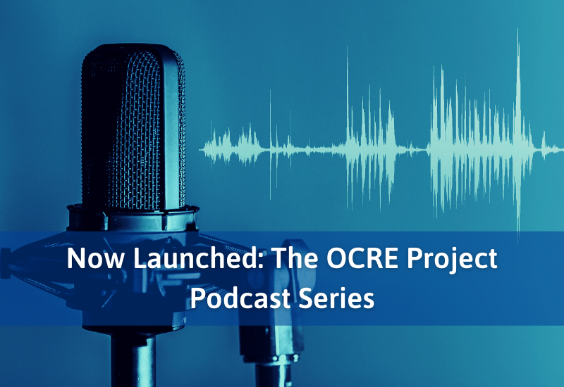
Now Launched: The OCRE Project Podcast Series
OCRE Project Director, David Heyns, Paolo Perulli, Sales Manager Enterprise and European Institutions at Sparkle and Paola Crobu, Project Manager of Multi-cloud Solutions at Sparkle met with the Sparkle Research for Education team in Rome to produce an exciting podcast series dedicated to the OCRE Project. The series, which is aimed at both highlighting the OCRE Framework and promoting the
EARSC takes part in a web-event “Geospatial Information for Digital Transformation” by the Norwegian Mapping Authority
Save the dates for the web-event “Geospatial Information for Digital Transformation” by the Norwegian Mapping Authority. Marc Tondriaux, the EARSC’s Board of Directors’ Chairman, will be presenting at the conference Day 3 (Friday 29th October) at 10am (CET) in the session on Future trends. During past 20 years, the Norwegian Mapping Authority has been implementing capacity
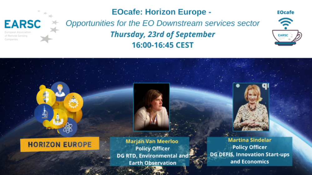
EOcafe: Horizon Europe – Opportunities for the EO Downstream services sector
Thursday 23th of September 2021 16:00-16:45 CEST Horizon Europe is the new EU research and innovation framework programme with a value of €95, 5 billion for a period of seven years (2021-2027). Aligned with the ambitious objectives of the European Green Deal, Horizon Europe will contribute to achieve a more sustainable and digital Europe. On
Webinar: Disruptive Technologies for Development (DT4D): Unleashing Innovation in Developing Countries
What Disruptive technologies are transforming the world but very few of these technologies are being designed and deployed to solve development challenges. The World Bank Group’s (WBG) Disruptive Technologies for Development (DT4D) Program aims to solve critical development challenges by identifying and piloting impactful disruptive technology solutions. The DT4D Challenge awards funding for 5-10 pilots each
Job Offer: IGN FI IS LOOKING FOR EARTH OBSERVATION DEVELOPMENT OFFICER – M/F
The space industry in relation to the Earth Observation sector currently represents a market worth about 4 billion euros worldwide, of which the European market accounts for about 1.2 billion. Earth Observation is a rapidly growing sector that offers numerous opportunities for innovation, boosted by a large range of applications able to create value in
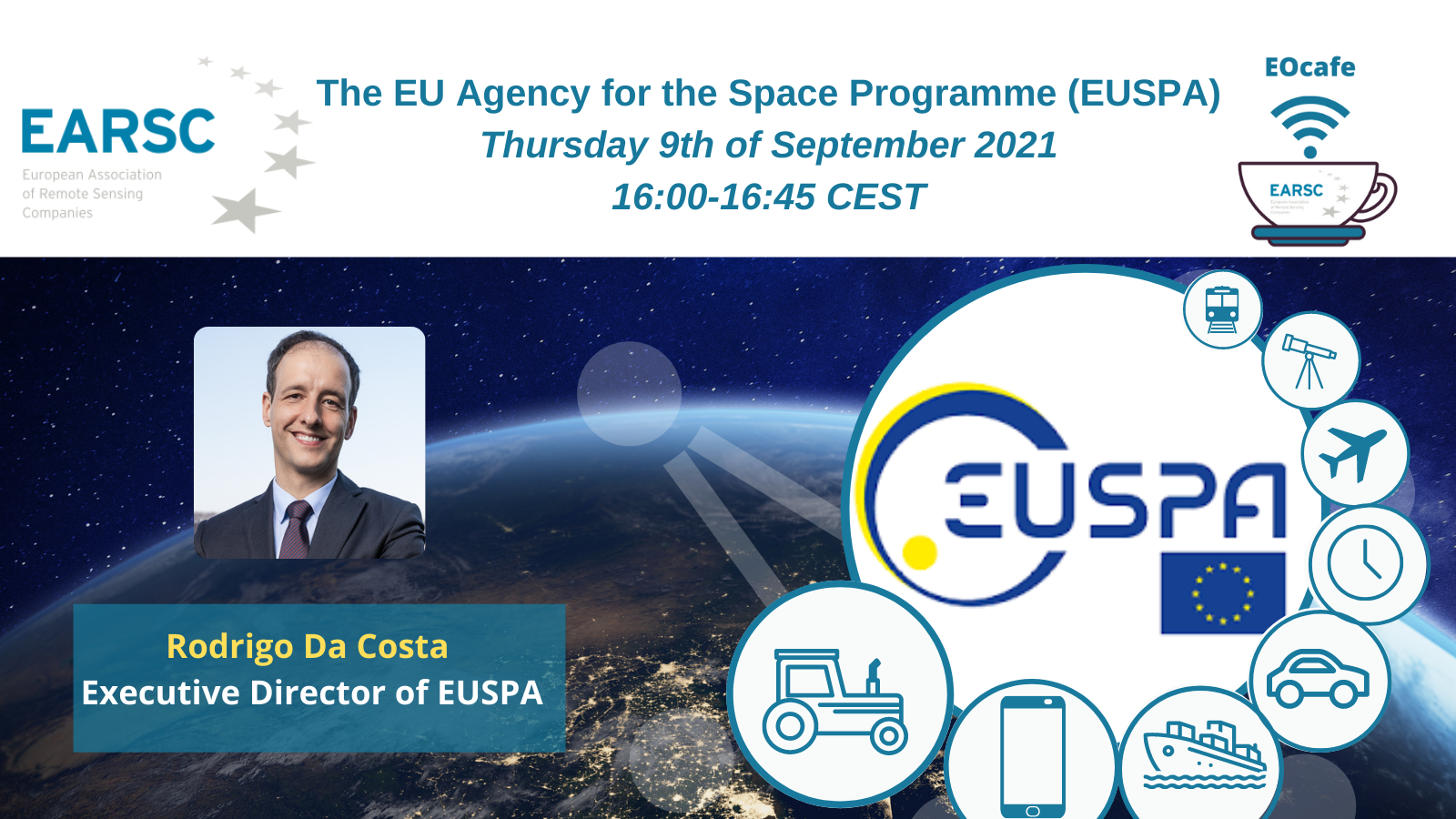
EOcafe: The EU Agency for the Space Programme (EUSPA)
The EU Agency for the Space Programme (EUSPA) Thursday 9th of September 2021, 16:00-16:45 CEST Set in the EU Space Programme regulation, EUSPA’s mission is to be the user-oriented operational Agency of the EU Space Programme. Building on the legacy of the European GNSS Agency, the EU Agency for the Space Programme’s overall objective is
Job Offer: Experienced Remote Sensing Project Manager – Space4Good
Space4Good provides meaningful geospatial insights for impact makers on earth throughcollaboration and open innovation. We are a group of impact-driven environmental engineers,geographic information experts and remote sensing specialists with the goal of contributing to the17 UN Sustainability Goals. We are doing this by delivering consultancy, bespoke project work and automated applications tolike-minded and like-hearted public
Job Offer – SpaceTec Partners – Consultant Space Sector
Are you a highly-motivated, technically-minded, critical thinker looking for your next challenge? Our consulting service lines span management consulting, market development and innovation advisory and we’re looking for individuals willing to grow their skills across typical consultant tasks such as: sector and market entry strategies, economic and cost benefit analyses, investment business cases, impact assessment of
Job Offer: SpaceTec Partners – Senior Consultant – Programme Management
SpaceTec Partners is a strategy, management and communications consultancy group based in Munich and Brussels. Our broad array of services includes strategy and technology consulting, communication activities, and interdisciplinary project management mainly for public institutions (e.g. European Commission, European Space Agency, European GNSS Agency, European Parliament, National Ministries, etc.) in the space and space applications
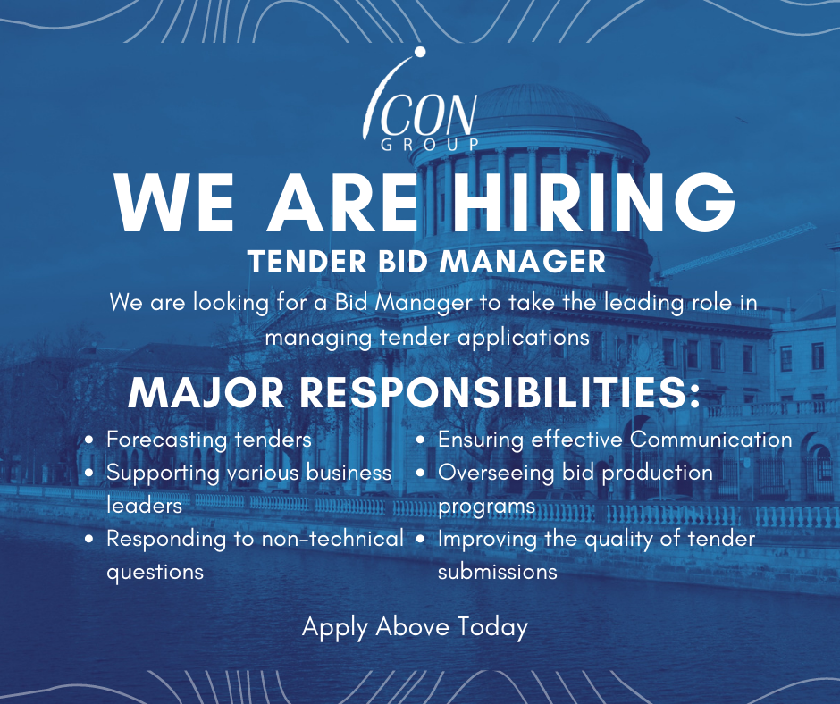
The Icon Group Job Offer: Tender Bid Manager Position
About Us The Icon Group is an interdisciplinary geoscience company. We specialise in EarthObservation, Environmental Monitoring, GIS and Spatial Data Analytics. We are a Europeanleader of earth imaging services and are Ireland’s largest processor of optical and imagedata.For over a quarter of a century, our bespoke approach has provided insight and assuranceto commercial and governmental
MEMBERS NEWS

New Job Opportunity at GAF AG Munich – “Project Manager Earth Observation & Copernicus LCLU downstream Services”
GAF AG is an internationally successfully operating company for cross-platform EO-based geoinformation solutions and for the development of innovative GIS and database applications. In addition to the reception and distribution of geodata, GAF holds a leading position in the areas of data refinement and geoconsulting due to its many years of expertise. With an international and

EARSC Board of Directors Election – Apply to Become One of the EARSC Directors 2024!
According to the Article 11 of the EARSC Statutes, the Board of Directors shall be renewed during the Annual General Meeting scheduled to be held in Brussels on June 13, 2024, during EXPANDEO 2024. The 9 Directors will be elected this year for a term of 2 years. The election is an opportunity for EARSC Full members to be involved in the

European cooperation on satellite mapping: The Danish Geodata Agency and EOMAP join efforts in mapping the shallow waters of Denmark.
Nørresundby (DK) / Seefeld (D) – By using Satellite-Derived Bathymetry (SDB), the Danish Geodata Agency and EOMAP are joining forces to contribute to the European Marine Observation and Data Network (EMODnet) Bathymetry partnership, and to integrate the SDB data into the Danish Depth Model (DDM) “Finding new ways to map shallow waters, where we only have very