The voice of the Earth Observation
Industry
Barents bloom, Sentinel-2A - processed by ESA, CC BY-SA 3.0 IGO

Discover the largest European
Earth Observation Network
Lake Balkhash, Kazakhastan, Sentinel 2 - processed by ESA, CC BY-SA 3.0 IGO

EARSC promotes the understanding
of our Planet for societal benefits
Brussels, Spot 5 Sqtellite - Airbus Defence and Space
EARSC 4 Pillars

Representing the Members
The core pillar of our activities is to support and promote our members. We achieve this goal mainly through projects which we undertake (see projects). Members’ views are gathered through a series of ad-hoc working groups dedicated to important topics. We inform our members through a monthly report and a dedicated portal about important news and information, as announced bid opportunities – and dedicated e-mails for key items.
Read More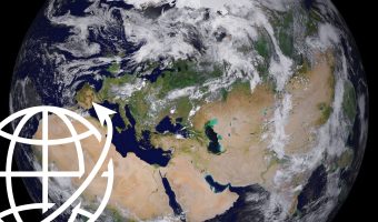
Market development & Internationalization
EARSC is engaged in a wide range of activities to develop new markets and business opportunities for our members. Our strategy is to engage users, identify needs and stimulate demand for European EO services both in Europe and abroad with complementary commercial and geographical approaches.
Read More
Promoting the industry
EARSC employs a range of sophisticated digital tools to promote the European EO sector. EARSC has three main digital tools which cover creating a shared vocabulary (EARSC TAXONOMY) , providing a common space to find EO companies, and a common space to discover ‘online’ EO services.
Read More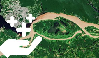
Showing the value of Earth Observation
The Earth observation sector delivers a wide range of social and environmental and economic benefits to citizens of Europe and the world. To properly and consistently value these impacts, EARSC leads the Sentinel Benefits Study (SeBS) project in which we measure the total societal impact of products and services coming from Sentinel satellite data.
Read MoreEARSC NEWS
SimActive’s Correlator3D Software and VITO
SimActive Inc., a world-leading developer of software solutions for the rapid generation of geospatial data, is pleased to announce the introduction of its Correlator3D™ product in Europe. Initial strategic customers include VITO in Belgium, the Flemish Institute of Technological Research. “We have been really impressed by the simplicity of the software and the quality of
Report Explores Use Of Earth Data To Support US National Priorities
The nation faces challenges in utilizing Earth science information to manage resources and protect public health, according to a NASA-sponsored report issued Monday by the U.S. Climate Change Science Program. The report examines the computer-based decision support tools that many government agencies use to make predictions and forecasts in areas such as agricultural productivity, air
Haiti, by Italian Space Agency data to "World Food Programme"
(WAPA) – Another time COSMO-SkyMed, the Italian satellite system for Earth Observation, has shot important pictures for the organizing and the management of emergencies. The pictures have been shot the 8th of September: they show in detail the areas hit by the hurricanes. COSMO-SKyMed is a satellite system for Earth observation by the Italian Space
China Launches Two Natural Disaster Monitoring Satellites
(Taiyuan, China (XNA) Sep 08, 2008). China launched two satellites to monitor the environment and natural disasters at 11:25 a.m. on Saturday 6 Sep. The two satellites, launched from the Taiyuan Satellite Launch Center in Shanxi Province and carried by a Long March 2C rocket, were expected to enhance the country’s capacity to forecast natural
More Than 40 Earth Observation Missions Team Up To Provide Data To GMES (Global Monitoring For Environment And Security)
(5 September 2008) ESA, as co-ordinator of GMES Space Component and related data access, received in response to a call 12 proposals offering to provide data from more than 40 European and non-European Earth Observation satellites to GMES Services over the next years. Among the satellites are ESA Member States’ missions, such as France’s Spot
More than 40 Earth Observation missions team up to provide data to the Global Monitoring for Environment and Security programme
(5 September 2008 ). ESA, as coordinator of the Global Monitoring for Environment and Security (GMES) Space Component and related data access, received in response to a call 12 proposals offering to provide data from more than 40 European and non-European Earth Observation satellites to GMES Services over the next years. Among the satellites are
GMES in Lille on 16 and 17 September
The Global Monitoring for Environment and Security (GMES) programme, one of Europe’s flagship projects alongside Galileo, will be in the spotlight for two days in September at the Grand Palais, Lille. Key CNES contribution Officially integrated into Europe’s space strategy in November 2001, GMES is also the main European component of the international Global Earth
ESA-EOMD Calls
AO 5870 – Geographic expansion for European and Canadian EO services. AO 5828 – Integrate new teechniques/technologies into current EO services . AO 5825 – Addressing new and evolving industry opportunities for EO based information services.
PCI Geomatics signs Memorandum of Understanding with the National Geomatics Center of China
Richmond Hill, Ontario – September 4, 2008: PCI Geomatics is pleased to announce the signing of a Memorandum of Understanding (MoU) with the National Geomatics Center of China (NGCC). The MoU outlines plans for collaboration on the development of a project for change detection with satellite imagery. Project results will include the creation of a
Spot Image Becomes Google Earth Enterprise Partner
Spot Image Corp. announced that it has been named a Google Earth Enterprise Partner. Spot Image Corp. will leverage this new partnership with Google to deliver imagery through current and planned web-based solutions to clients through Google Earth. Spot Image Corp. will develop ‘ready-to-use’ image data sets for Google Earth and Google Earth Enterprise users
Earth Observation Science Requirements for Characterizing and Monitoring Biodiversity
This contribution outlines how GEOSS (Global Earth Observing System of Systems) can aid current biodiversity monitoring systems by creating links with other Earth Observation networks to help fill in gaps in our present knowledge.
ISRO arm’s revenue up at Rs 940-cr on satellite launches
Bangalore, Aug. 30 Two commercial satellite launches made from Sriharikota during 2007-08 have driven up the revenue of ISRO’s commercial arm Antrix Corporation to Rs 940 crore for that year.
An Interview With Michael Fehringer GOCE System Manager
Michael Fehringer is responsible for overseeing the system design of the GOCE mission, which means ensuring that the satellite and related data-processing facilities all meet the scientific and technical requirements that were originally laid down when the mission was selected. Michael Fehringer, an Austrian national, has been working for the GOCE Project at ESA’s European
First Commercial Satellite Constellation Successfully
The next generation of earth observation and geoinformation services begin with RapidEye’s constellation of five satellites.
GeoEye to Launch World's Highest Resolution Commercial Earth-Imaging Satellite
GeoEye, Inc. announced today the launch of the world’s highest resolution, commercial Earth-imaging satellite is scheduled for September 4, 2008, from Space Launch Complex-2 at Vandenberg Air Force Base, California. The planned launch time is 11:50:57 a.m. PDT (2:50:57 p.m. EDT). A Flight Readiness Review was conducted on August 28 and the launch vehicle, launch
GOCE Earth Explorer satellite to look at the Earth’s surface and core
Earth’s gravitational field observation
MEMBERS NEWS


