The voice of the Earth Observation
Industry
Barents bloom, Sentinel-2A - processed by ESA, CC BY-SA 3.0 IGO

Discover the largest European
Earth Observation Network
Lake Balkhash, Kazakhastan, Sentinel 2 - processed by ESA, CC BY-SA 3.0 IGO

EARSC promotes the understanding
of our Planet for societal benefits
Brussels, Spot 5 Sqtellite - Airbus Defence and Space
EARSC 4 Pillars

Representing the Members
The core pillar of our activities is to support and promote our members. We achieve this goal mainly through projects which we undertake (see projects). Members’ views are gathered through a series of ad-hoc working groups dedicated to important topics. We inform our members through a monthly report and a dedicated portal about important news and information, as announced bid opportunities – and dedicated e-mails for key items.
Read More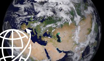
Market development & Internationalization
EARSC is engaged in a wide range of activities to develop new markets and business opportunities for our members. Our strategy is to engage users, identify needs and stimulate demand for European EO services both in Europe and abroad with complementary commercial and geographical approaches.
Read More
Promoting the industry
EARSC employs a range of sophisticated digital tools to promote the European EO sector. EARSC has three main digital tools which cover creating a shared vocabulary (EARSC TAXONOMY) , providing a common space to find EO companies, and a common space to discover ‘online’ EO services.
Read More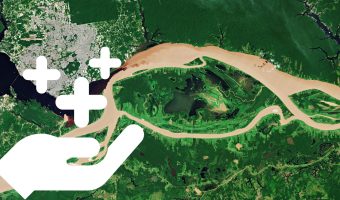
Showing the value of Earth Observation
The Earth observation sector delivers a wide range of social and environmental and economic benefits to citizens of Europe and the world. To properly and consistently value these impacts, EARSC leads the Sentinel Benefits Study (SeBS) project in which we measure the total societal impact of products and services coming from Sentinel satellite data.
Read MoreEARSC NEWS
EARSeL Workshop: GMES-Global Monitoring for Environment and Security
Call for Papers. Extended abstract submission due date: 31 March 2007.
Workshop
GMES: Global Monitoring for Environment and Security
Bolzano/Bozen, Italy, 7 to 8 June 2007
in the framework of the
27th EARSeL Symposium Geoinformation in Europe
Bolzano/Bozen, Italy, 4-7 June 2007 (Source EARSeL)
Alliance for Earth Observations to Testify Before Senate Today
Hearing to Focus on Decline in U.S. Satellite Observations of Earth (Source Alliance for Earth Observations)
The Earth as a Work of Art
On the occasion of the German Presidency of the EU Council in the first half of 2007, the Helmholtz Association of German Research Centres in cooperation with the German Aerospace Center (DLR) is staging the open-air exhibition KUNSTWERK ERDE (The Earth as a Work of Art) in the heart of the 'European Quarter' in Brussels. (Source Helmholtz)
First Space call in FP7
Infoday and Brokerage Event on 8 March 2007 Registration form Agenda Location On 8 March 2007 the National Contact Point (NCP) Space Germany organises jointly with the NCPs from The Netherlands, Austria and Luxembourg an information day at the University of Duesseldorf, Germany (lecture hall: HS 26.11). Potential applicants from Europe are invited to participate,
UN praises Thai plan for earth observation satellite
As criticism mounts over Thailand's ambitious plan to have its own earth observation satellite, the United Nations' space agency says the move will help to raise awareness of the peaceful use of space technology in developing countries.(The Nation)
Better geographical data: conciliation agreement approved by EP on INSPIRE
Europe needs better map-based information to support its policies, especially on the environment. A new database designed to achieve this - known as INSPIRE -should be in place by early 2009. Parliament and the Council struck a deal which was approved by MEPs which will enable data to be shared across the EU, without undermining high quality services in the Member States.(Source Europarl)
Outer Space Scientific and Technical Subcommittee to Hold 44th Session (AU)
The newly established space-system-based disaster management programme, a safety framework for nuclear power sources in outer space, mitigation guidelines for space debris and International Heliophysical Year 2007 will be the key agenda items at the 44th session of the Scientific and Technical Subcommittee of the United Nations Committee on the Peaceful Uses of Outer Space (COPUOS), which will take place in Vienna, Austria, from 12 to 23 February. (Source Spaceref)
OGC(R) Seeks Comment on Observations & Measurements Specification
the candidate OpenGIS Observations & Measurements (O&M)
Specification for release for a thirty day public comment period. The
document can be downloaded at Opengeospatial
GeoEye Makes Final Debt Payment For The Purchase Of Space Imaging
GeoEye has announced the final payment on the $50 million credit facility that it drew down in January 2006 to fund the acquisition of the assets of Colorado-based Space Imaging. While the two and one-half year facility did not have an amortization repayment schedule, it was structured to be repaid from excess cash flow generated by the assets purchased from Space Imaging. (Source GeoEye)
NOAA announces 2008 budget request
Retired Navy Vice Adm. Conrad C. Lautenbacher, Ph.D., undersecretary of commerce for oceans and atmosphere and NOAA administrator, announced highlights of President Bush's proposed 2008 budget for the Commerce Department's National Oceanic and Atmospheric Administration. Lautenbacher said NOAA's request totals $3.8 billion or an increase of 3.4 percent over the administration's 2007 request. "The President's budget makes a substantial investment in our oceans that will pay dividends for years to come," said Lautenbacher. "We will be able to make great progress in the goals laid out in the President's Ocean Action Plan of ensuring sustainable use of ocean resources, protecting and restoring marine and coastal areas and enhancing ocean science and research." (Source NOAA)
Definiens GMES Award
Extended deadline submissions until February 20th, 2007 Dear GMES Partner, Your work contributes significantly to the development of operational services from remote sensing imagery and geospatial data, which is the major goal of the European GMES. We are proud that Definiens eCognition?• Technology benefits GMES service chains by providing accurate, cost-efficient and reliable
MEMBERS NEWS


