The voice of the Earth Observation
Industry
Barents bloom, Sentinel-2A - processed by ESA, CC BY-SA 3.0 IGO

Discover the largest European
Earth Observation Network
Lake Balkhash, Kazakhastan, Sentinel 2 - processed by ESA, CC BY-SA 3.0 IGO

EARSC promotes the understanding
of our Planet for societal benefits
Brussels, Spot 5 Sqtellite - Airbus Defence and Space
EARSC 4 Pillars

Representing the Members
The core pillar of our activities is to support and promote our members. We achieve this goal mainly through projects which we undertake (see projects). Members’ views are gathered through a series of ad-hoc working groups dedicated to important topics. We inform our members through a monthly report and a dedicated portal about important news and information, as announced bid opportunities – and dedicated e-mails for key items.
Read More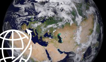
Market development & Internationalization
EARSC is engaged in a wide range of activities to develop new markets and business opportunities for our members. Our strategy is to engage users, identify needs and stimulate demand for European EO services both in Europe and abroad with complementary commercial and geographical approaches.
Read More
Promoting the industry
EARSC employs a range of sophisticated digital tools to promote the European EO sector. EARSC has three main digital tools which cover creating a shared vocabulary (EARSC TAXONOMY) , providing a common space to find EO companies, and a common space to discover ‘online’ EO services.
Read More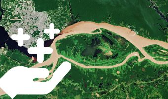
Showing the value of Earth Observation
The Earth observation sector delivers a wide range of social and environmental and economic benefits to citizens of Europe and the world. To properly and consistently value these impacts, EARSC leads the Sentinel Benefits Study (SeBS) project in which we measure the total societal impact of products and services coming from Sentinel satellite data.
Read MoreEARSC NEWS
EARSC and AGI sign MoU
The European Association of Remote Sensing Companies (EARSC) & the Association of Geospatial Industries (AGI) sign MoU for strengthening relationships between European and Indian companies in the Geospatial Industry.
SATELLITE RUSSIA & CIS 2018
On April, 19-20, 2018 COMNEWS holds the 10th International Conference SATELLITE RUSSIA & CIS 2018 in Moscow, Russia.
GeoBuiz Summit 2018 : Collaborative Co-existence at the Forefront of Fourth Industrial Revolution
EARSC is participating to the 2018 edition of GeoBuiz Summit, taking place from 15th-16th January, at HICC, Hyderabad, India. This year, the conference aims to contribute to the attendees’ experiences and knowledge and also provide directions and dimensions through the spirit of collaborative and collective intelligence.
Workshop "Creating bridges between EO Service providers and Researchers"
EARSC is hosting a session with DG-Connect on e-infrastructures calls on 25 January 2018 in Brussels.
Copernicus for Agriculture industry workshop
The workshop will be held on February 5th, 2018 in Rue van Maerlant 2, 1049 Brussels.
SPACED workshop: Using Earth Observations to Protect Natural Landscapes
The ECOPOTENTIAL H2020 project, focusing its activities on blending Earth Observations from remote sensing, field measurements, data analysis and modelling of current and future ecosystem conditions and services, is organising the workshop “SPACED: Using Earth Observations to Protect Natural Landscapes” in Brussels on the 10th of January 2018, from 9.00 to 17:30.
EuroGEOSS infographics
EuroGEOSS is Europe’s part of the Global Earth Observation System of Systems (GEOSS). It brings together all of the Earth observation resources available in Europe so that they can be used more effectively.
How Earth Observation became Europe’s “Silicon Valley”
Extracted from the Copernicus Observer Newsletter
Brussels, 1 December 2017. The Copernicus Programme with its full, free and open data policy is tapping into the core of the open data movement that is powering today’s tech breakthroughs, just like open source has been key to most of the innovation in the last decades.
The African Union Commission Awards Thirteen Consortia of Institutions to Implement the GMES and Africa Support Programme
November 28, 2017. The African Union Commission (AUC) officially awards grants to thirteen successful consortia of institutions that will serve as Regional Implementing Centres for the Global Monitoring for Environment and Security and Africa (GMES and Africa) Support Programme.
Invitation to the the 3rd EARSeL SIG LU/LC and NASA LCLUC joint Workshop
The 3rd EARSeL SIG LU/LC and NASA LCLUC joint Workshop will be at the Mediterranean Agronomic Institute of Chania, Greece, 11th -12th July, 2018.
PlanetObserver presents new PlanetSAT Updates imagery basemap of the United States and Mexico
The French company PlanetObserver, specialized in geospatial data production, has just finalized the new PlanetSAT Updates imagery basemap of the United States and Mexico. Processed with fresh and cloudless Landsat 8 source data, this new basemap covers more than 10 million square kilometers at 15-meter resolution. With an advanced natural color imagery processing, this high quality mapping product provides up-to-date and detailed geographic information, perfect for 1:50,000 scale mapping.
EARSC Position Paper on Earth Observation Services Industry Internationalisation & Economic Diplomacy
21 November 2017. EARSC publish today its position paper on Earth Observation Services Industry Internationalisation & Economic Diplomacy.
Two new Earth Explorer concepts to understand our rapidly changing world
15 November 2017. ESA has chosen two concepts, FORUM and SKIM, to be developed further and compete to be the ninth Earth Explorer mission.
Turning Up the Volume in EO Imagery
Nov 14th, 2017 by Dallas Kasaboski, NSR.
Satellite imagery has traditionally been sold by the scene. Customers would look at certain criteria, and satellite operators would match their request with available archived or tasked images. Sales cycles were long, and the focus was on the quality and the resolution of the data.
EarthServer: 1+ Petabyte Analysis-Ready Datacubes
November 2017 – EarthServer, the European Union Big Data initiative, has reached the next milestone: in the second phase extending through April 2018, the Italian data provider MEEO S.R.L. exceeds 1 Petabyte of spatio-temporal, analysis ready data processed through its operational Earth Observation Data Service.
MEMBERS NEWS


